


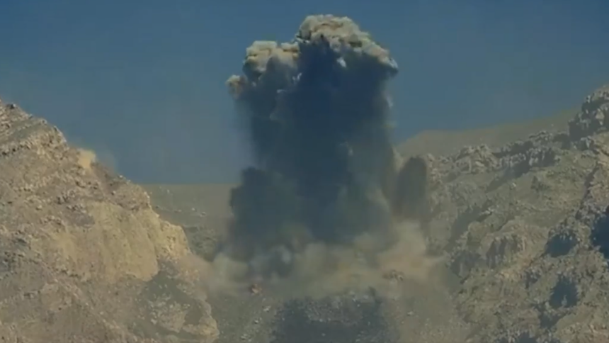
Mount Semeru, Indonesia’s most volatile volcano, erupted at least 10 times within a 13-hour window on October 13, 2026. The volcano has entered a period of intense activity, prompting authorities to establish strict exclusion zones and urgent warnings.
The most violent bursts produced towering ash columns that rose up to 900 metres above the summit. Strong atmospheric winds pushed the dense volcanic ash clouds toward the southwest and west. As a result, gray dust has blanketed nearby agricultural slopes. The surrounding valleys are heavily populated by farming communities, who primarily rely on the fertile volcanic soil. Therefore, this rapid volcanic activity has put thousands of lives at risk.
Threat Profile
Authorities warn that the primary danger to human life during this event is not the vertical ash column. The threat arises from gravity-driven flows rushing down the mountain’s natural channels. These fast-moving avalanches, known as pyroclastic flows, comprise superheated gas, ash, and rock fragments. The avalanches can reach temperatures exceeding 700°C and speeds over 100 km/h. They are known for destroying everything in their path.
Meanwhile, Indonesia is experiencing seasonal rainfall. During heavy rainfall, accumulated volcanic debris on the upper slopes can quickly mix with rainwater. The resulting are created can wipe out bridges, roads, and villages along the riverbanks.
Mount Semeru has been exceptionally restless this year. Authorities have recorded approximately 2,000 individual eruptions during 2026 alone.
Emergency Directives
Indonesia’s Center for Volcanology and Geological Hazard Mitigation (PVMBG) has adopted a strict stance on public safety. Authorities have classified the volcano at Level III (Siaga/Alert). This is the the second-highest level in Indonesia’s four-tier volcanic warning system.
All human activity has been completely banned along the Besuk Kobokan river sector up to 13 kilometres from the summit. This region serves as the primary pathway for pyroclastic flows. In addition, both tourists and locals are prohibited from entering areas within 5 kilometres of the crater rim. The directives aim to prevent casualties from flying incandescent rocks and toxic gas bursts.
Authorities have directed residents living within 500 metres of the Besuk Kobokan riverbanks to remain highly vigilant. They have been asked to prepare for immediate evacuation if heavy rains begin.
These concerns are heightened by the volcano’s history of sudden escalations. In December 2021 and December 2022, major eruptions resulted in several fatalities and displaced thousands of villagers. Therefore, the current frequency of eruptions is a deeply concerning development for local disaster mitigation agencies.